New will help Kenyan farmers plan for both drought and floods
(This story appeared first on Tuesday on the website Thomson Reuters Foundation.)
Kenya will launch its first localized weather-modelling system early next year, providing key data on how climate change will impact crop production across the East African nation in the decades to come, the project’s founder said on Tuesday.
Developed by researchers at Kenya’s Jomo Kenyatta University of Agriculture and Technology, the Climate Atlas will provide projections on rainfall and temperature patterns across Kenya’s 47 counties from the year 2050 to 2100.
John Wesonga, lead developer of the web-based Climate Atlas platform, said there were countless global climate-modelling systems available, but none provided localized data for Kenya over a long period.
“The Climate Atlas will provide us with future scenarios of what the weather patterns will be like at a county-level in Kenya,” Wesonga told the Thomson Reuters Foundation.
“We are looking for data such as which locations will we see the highest and lowest temperatures and rainfall, how high and low are the temperatures and rainfall likely to be, what time of year they will happen, and how long they will last.”
‘Right investment’
Based on those projections, policymakers, researchers, businesses and farmers will able to shift to interventions such as using more resilient crop varieties to improving drainage during drought and floods respectively.
Irene Koomen from the Netherlands-based Wageningen University and Research, which is supporting the Climate Atlas project, said localized long-term climate mapping would ensure investments in agricultural production were done wisely.
“Investing in irrigation is useful if more droughts are predicted, but if the long-term prediction is that rainfall will increase, a different investment – such as greenhouses for tomato production – might be more sensible,” said Koomen.
“Counties in Kenya are now often investing without clear evidence if the investment is the right one.”
Food insecurity
Climate change is taking a toll across East Africa and increasingly erratic weather – from recurring droughts to heavy rains – is becoming commonplace in countries such as Kenya, Somalia, Uganda and Ethiopia.
Since October, floods sparked by heavy rains have inundated farmland, destroyed infrastructure and killed at least 48 people in central, western, north-eastern and coastal parts of Kenya.
The country was already facing increase levels of hunger prior to the floods, with more than 3 million people projected to be in crisis and emergency levels of food insecurity, according to the National Drought Management Authority.
The Climate Atlas is expected to launched in Kenya in March next year. The model was first developed in the Netherlands and is used by provincial authorities for planning purposes. It is also being developed for Bangladesh and Indonesia.
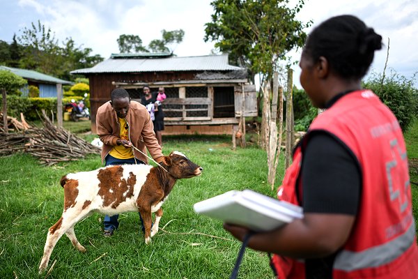
Kenya Red Cross community health volunteer Selena Ruto visits the Kibet family in Narok county last August to discuss the risk of anthrax. Local herders rely on cows and other livestock, but droughts often drive them to seek greener pastures further afield, causing domestic animals to mingle with wild game, occasionally resulting in outbreaks of blue tongue, anthrax and other diseases and posing a health risk to people. With the support of IFRC and USAID funding, the Red Cross is helping to improve community’s ability to respond before, during and after outbreaks. (Photo: Corrie Butler/IFRC)