El Niño: ‘Remarkable agreement’ among models points to rapid strengthening
By Andrew Kruczkiewicz, Climate Centre, New York
Citing “remarkable agreement” by the models, the World Meteorological Organization says the current El Niño will “strengthen rapidly over the coming months, increasing the likelihood of heatwaves, droughts, heavy rainfall and other extreme-weather events in many parts of the world.”
The WMO’s latest monthly climate update issued Friday indicates “a rapid development into a strong El Niño event” between this month and September.
WMO Secretary-General Celeste Saulo said: “The WMO community has launched an unprecedented mobilization to coordinate activities across the United Nations and at regional level to support governments, humanitarian organizations and climate-sensitive sectors.
“Advanced seasonal forecasts and early warnings are vital to save lives and cushion the impact on our economies and our communities.”
There is now “an overwhelming likelihood of above average temperatures across most land areas between 60°S and 60°N, or nearly all populated areas outside polar regions,” the outlook says.
The magnitude, duration and timing of hot anomalies is likely to vary, however, and there may also be below-average temperatures due to other climate factors and variability interacting with El Niño; comprehensive risk-informed early action should be based on data for both long and short timescales.
There is also an “enhanced likelihood” of above-normal rainfall across the central and eastern equatorial Pacific, the WMO adds, with below-normal rainfall in the eastern tropical Indian Ocean, the Indian Subcontinent and much of Australia being also among El Niño impacts.
‘The WMO community has launched an unprecedented mobilization to coordinate activities across the UN’
The Sahel is forecast to receive below-normal rainfall from now to September, with above-normal rainfall for the eastern Horn of Africa from September to January. El Niño always combines with other factors so seasonal forecasts like those from national and regional sources such as ICPAC should be closely monitored.
Below-normal rainfall is also forecast for parts of Central America, the Caribbean and north-west South America, with wetter-than-average conditions in the south-west US.
There is an increased chance of above-normal rainfall in southern Europe and below-normal rainfall in northern Europe, but here “forecast confidence remains lower than in many other regions,” the WMO says.
El Niños, which typically occur every two to seven years and last up to a year, reach maximum intensity between November and February and exert their strongest influence on global temperatures during the year following their onset.
During the 2023–24 El Niño, which actually peaked twice, below average precipitation coupled with ongoing forest degradation contributed to what were described as the Amazon’s worst wildfires in at least 20 years.
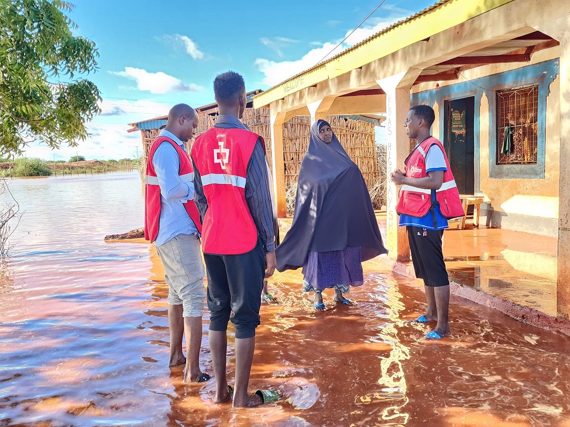
The two East African rainy seasons between October 2023 and May 2024 were exceptionally intense and linked to El Niño. All but one of Kenya’s 47 counties experienced flash floods that caused large-scale loss of life and displaced more than 700,000 people.
Now is the time to ensure risk management includes the best possible understanding of critical temperature and precipitation thresholds, and that financing, human resources and logistics are ready to be activated to support the most vulnerable, exposed and under-served communities.
Kenya Red Cross volunteers fan out across the country in November 2023 to assist communities affected by successive waves of flooding blamed in part on a double-barrelled El Niño. With the emergency ongoing, an IFRC-DREF grant of 750,000 Swiss francs that month was aimed at assisting 150,000 people. (Photo: Suleiman Saney Abdinoor/Kenya Red Cross)