Blog: Horizon Europe project plugs gap between short- and long-term cyclone forecasting in Madagascar
By Bettina Koelle, Climate Centre, South Africa
Every cyclone season Madagascar faces the same dilemma: short-range forecasts can tell you what’s coming in the next few days while seasonal outlooks indicate what’s likely months out. But the two- to four-week window between, when evacuation and pre-positioning decisions actually need to be made, has long been a blind spot.
The latest episode of The Climate Carrot, the Climate Centre’s podcast, digs into how the Anticipatory Climate Adaptation for Communities in Africa (ACACIA) project, supported by Horizon Europe, is closing that gap, helping turn forecasts into action on the ground.
Eric Kolstad, a professor at the Norwegian Research Centre and ACACIA coordinator, explains: “The project exists precisely because that window has been neglected. There’s a gap between forecasting the weather over a few days [and] five days up to three or four weeks. There haven’t been a lot of forecasts available.
“We’re trying to fill that gap with some new forecast products that do address this time scale. However, better products alone don’t solve the problem. These forecasts also have to reach the people who need to act on them.”
Joshua Talib, of the European Centre for Medium-Range Weather Forecasts, an ACACIA partner agency, says the concept is to couple “scientific expertise in cyclone modelling and forecasting with local knowledge about different sources of predictability of tropical cyclones in the region.”
That’s where ACACIA’s design becomes interesting, pairing this local and international expertise with humanitarian delivery through the Malagasy Red Cross.
Early warning is just the first step: acting on it is what saves lives
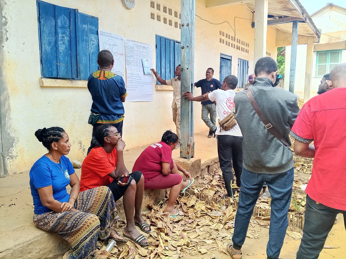
Enhanced Vulnerability and Capacity Assessments conducted under ACACIA further link science to community realities and priorities. In Madagascar’s Sofia region, for example, communities have produced 19 action plans centred on their top two hazards: cyclones and flooding.
The detailed approach that ties science and the community response together is described as a co-production test-bed, “a forum where we bring together forecast users, forecast producers and researchers to create a space to develop forecasts together,” says Linda Hirons of the UK National Centre for Atmospheric Science.
“A test-bed like this really transforms the user from somebody who receives a forecast to one who is a participant in how that forecast is developed.”
“Rather than a one-way communication of data, it’s a weekly loop of evaluation and adjustment between the people issuing forecasts and the people acting on them.”
That loop feeds directly into the Malagasy Red Cross operational cycle. Once Météo Madagascar flags a system forming in the Indian Ocean or Mozambique Channel, Red Cross branches in cyclone- and flood-prone regions are alerted so communities are warned before the storm makes landfall.
Early evidence suggests the model is shifting behaviour on the ground: a baseline study of 3,600 households in Sofia found 66 per cent reinforcing walls, roofs and windows ahead of a hazard, a similar proportion storing food, and nearly half storing drinking water, with smaller but meaningful shares protecting valuables, saving emergency funds or securing documents.
Innovation in forecasting only saves lives if it’s built jointly with the people who have to act on it. Early warning is just the first step – acting on it is what saves lives.
A 2025 EVCA session conducted through a climate change lens in a rural community in Madagascar. Enhanced Vulnerability and Capacity Assessments conducted under ACACIA help link science to community realities and priorities. In the country’s Sofia region, communities have produced 19 action plans centred on their top two hazards: cyclones and flooding. (Photo: MRC)