Australian forecasters: Current El Niño could be among most intense since 1950
By the Climate Centre
The Australian Bureau of Meteorology last week joined others in formally declaring that El Niño underway in the tropical Pacific.
“Forecasts are pointing towards a strong to very strong El Niño event, based on the extent of warming in the central tropical Pacific. Around half of the models indicate this event could peak at levels among the highest observed since 1950,” according to the BOM, which uses slightly different measuring criteria to US forecasters.
Ocean temperatures have been very warm globally, the Australian forecasters add – the warmest for May in a record that began in 1900.
“The long-range forecast provides the best guidance on likely rainfall and temperature patterns [for Australia] in the coming months, taking into account all influences from the oceans and atmosphere.”
El Niño “is particularly damaging to Australia as it affects agricultural production in the country, which ranks among the world’s largest exporters of wheat, sugar and beef,” Reuters reported from Sydney.
“The last El Niño experienced in Australia from 2023 to 2024 caused the driest three-month period on record.”
‘Anticipatory action taken collectively by the humanitarian community supported by OCHA is helping drive a fundamental shift’
A few days before the Australian statement, US scientists reported “a 63 per cent chance of … a ‘very strong’ El Niño,” while earlier this month UN Secretary General António Guterres said it would “pour fuel on the fire of a warming world. Impacts will hit even harder, travel even farther, and cross borders with devastating speed.”
The United Nations Office for the Coordination of Humanitarian Affairs said in May – shortly before the likelihood of a strong El Niño increased significantly – that it was getting ready for severe impacts.
“What does a strong El Niño imply? Think about devastating floods, drought that cause widespread hunger, disease outbreaks and forced displacement,” OCHA’s Priscilla Lecomte wrote in May.
Over the period of the last El Niño, the OCHA-managed UN Central Emergency Response Fund allocated US$ 72.7 million across 11 countries, supporting 2.5 million people – with most of that money released before or at the very early stages of impacts.
“CERF-funded anticipatory action taken collectively by the humanitarian community supported by OCHA is helping drive a fundamental shift in how we respond to predictable crises such as droughts and floods,” said Regina Omlor, who leads anticipatory action at CERF.
Twenty-two plans to take anticipatory action supported by OCHA and CERF are already in place to address the impact of droughts, floods and tropical cyclones on people and several more are being developed, Lecomte added in May.
But the humanitarian system is “overstretched and underfunded. Preparedness interventions are being deprioritized, and key forecasting tools such as Famine Early Warning and System Network or FEWS NET, have been scaled back or closed, limiting early warning capacity.”
“Global shocks are compounding the challenge. Disruptions to energy markets and shipping routes because of the conflict in the Middle East have driven up the price and availability of fuel, fertilizers and food. In import‑dependent regions such as the Caribbean, households already struggling with high costs could be pushed into crisis if El Niño brings drought and crop losses.”
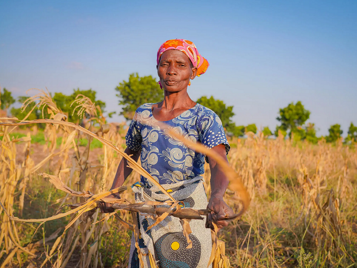
Maness stands in her drought-affected maize field in Chikwawa district, Malawi, that she farms with her husband Waison. Failed rains linked to El Niño devastated crops and deepened food insecurity for farming families there in 2024. (File photo: Francis Thawani/WFP)